Armenia on Ancient Maps
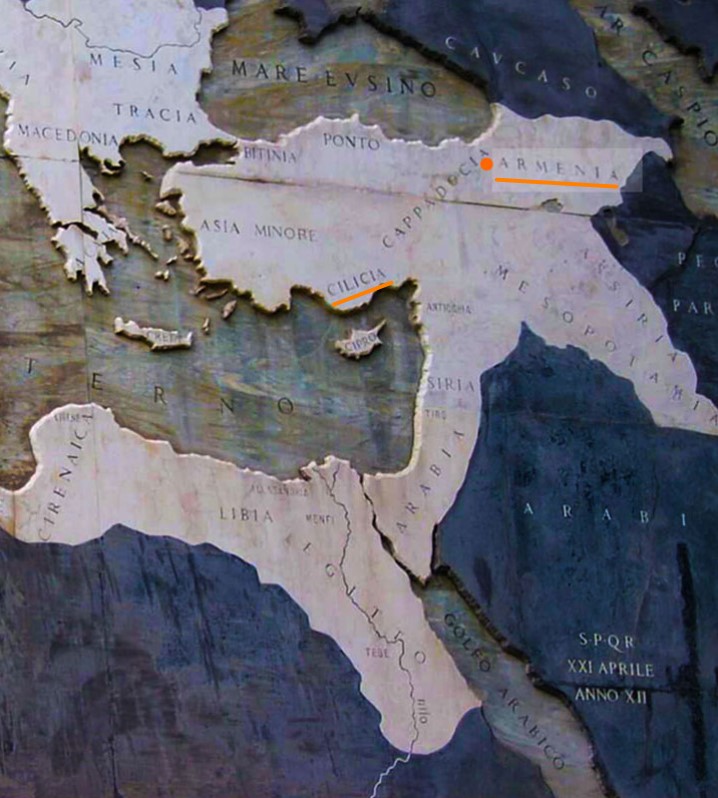
Armenia and Cilicia, map “Rome in 146 BC”
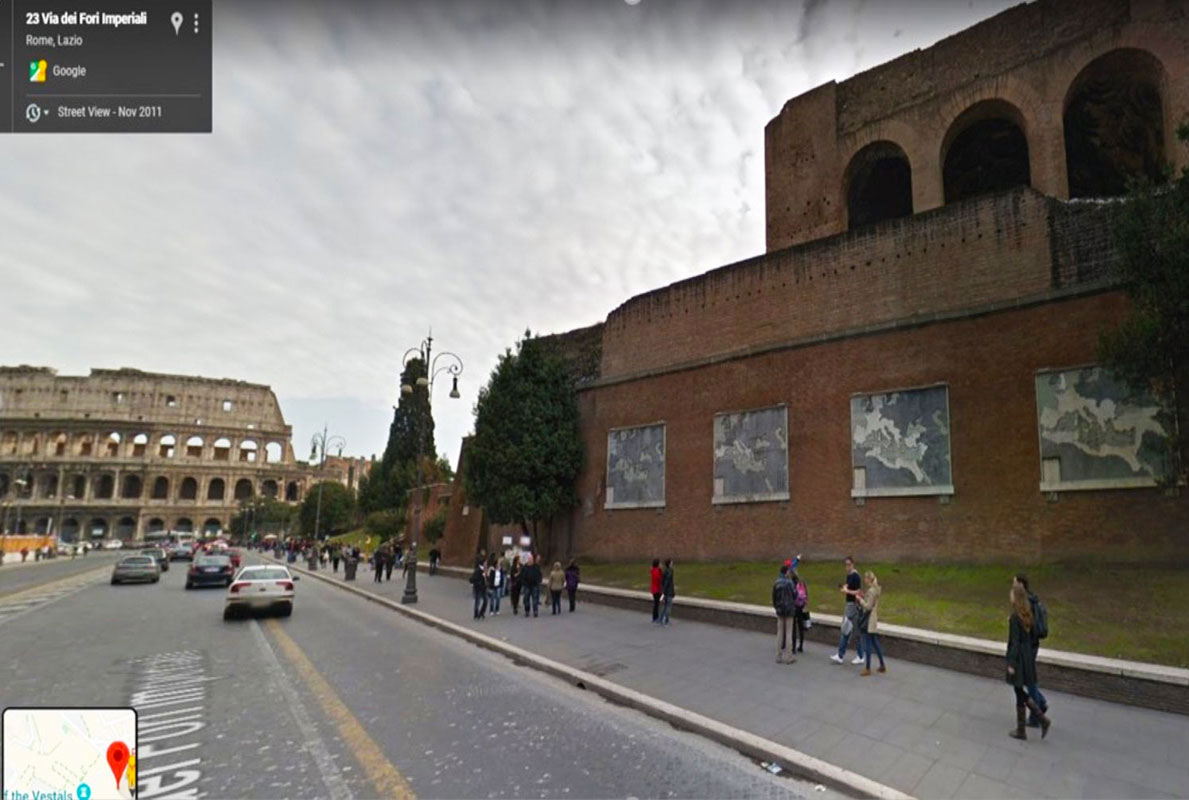
Basilica of Maxentius, near Colloseum
Address: Clivo di Venere Felice, 00186 Roma RM
Armenia and Cilicia on the anchient Roman map
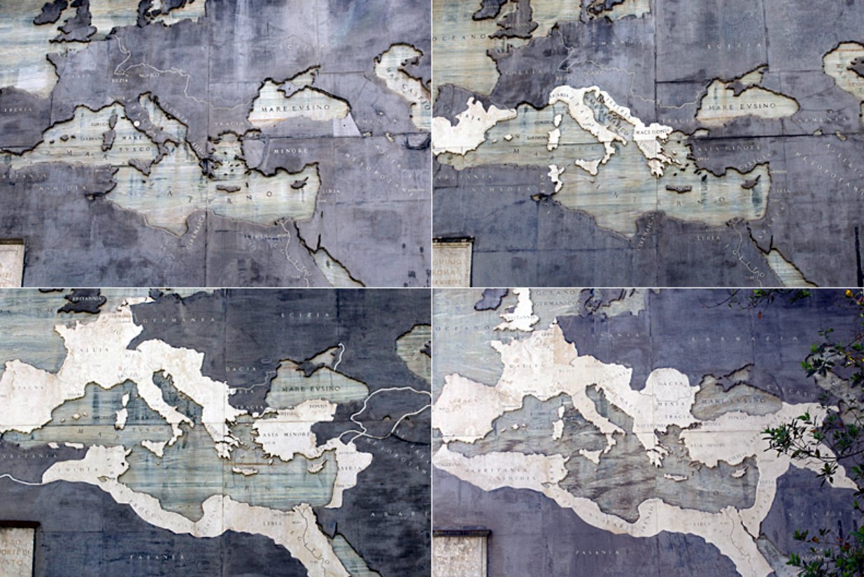
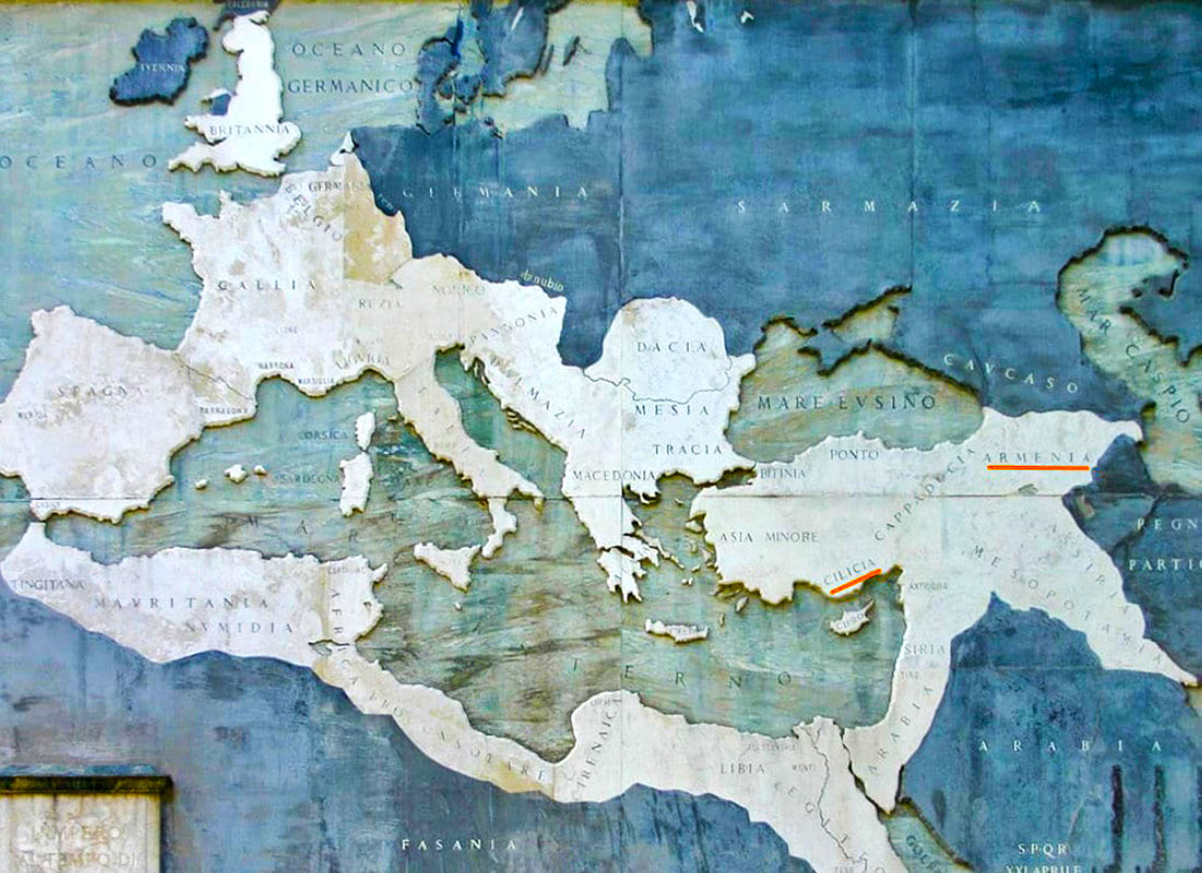
Marble Maps showing the expansion of Rome from 760BC
Map of Armenia in the Hall of Geographical Maps or Medici Hall of Maps (Sala delle Carte Geografiche), Palazzo Vecchio, Florence, Italy
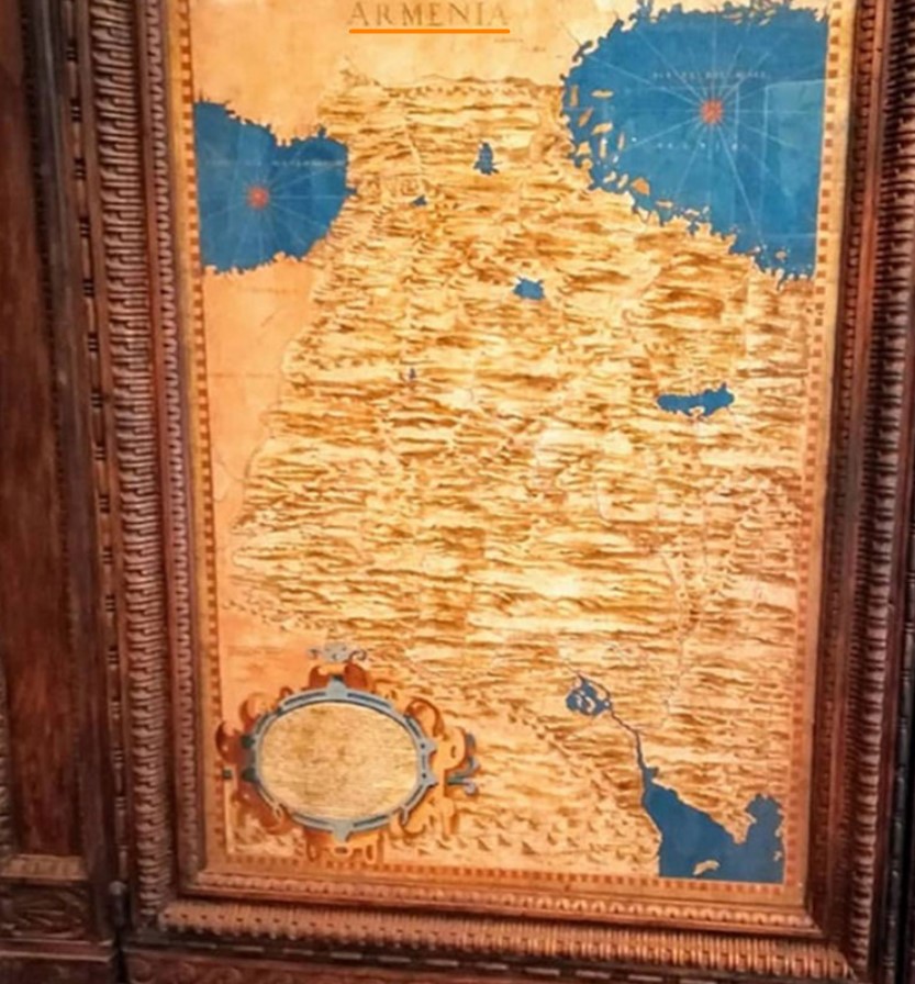
Map of Armenia, behind which is a secret passage way
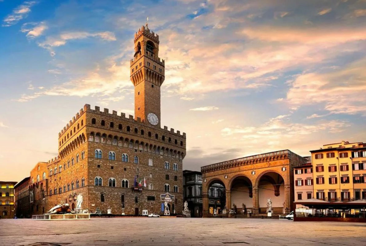
Palazzo Vecchio, Florence, Italy
Address: Piazza della Signoria, 50122 Firenze FI, Italy
Map of Armenia, behind which is a secret passage way
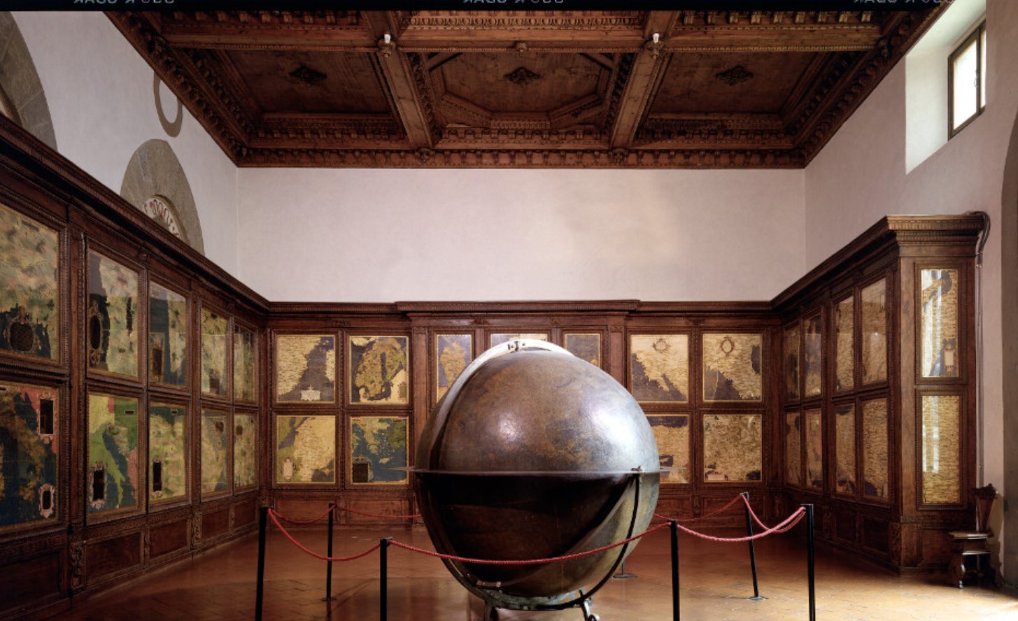
Medici Hall of Maps, Sala delle Carte Geografiche
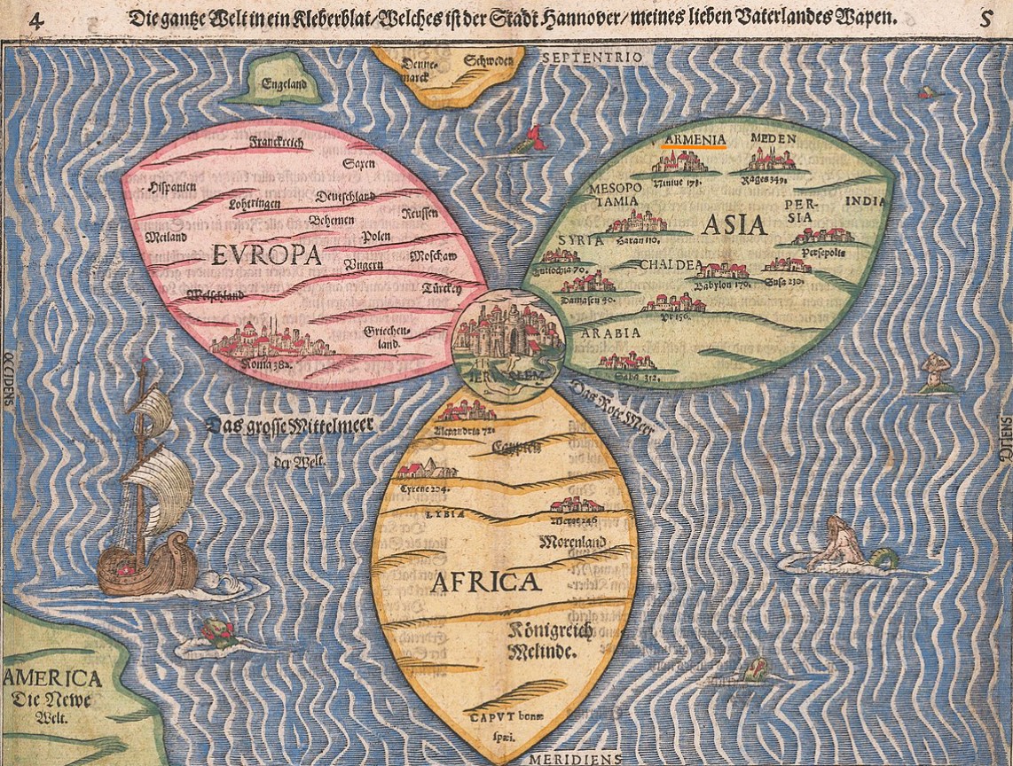
World Map by Heinrich Buenting or The World in a Cloverleaf, 1581, National Library of Israel, Jerusalem
Pictorial map by Heinrich Bünting, depicting Asia as Pegasus, 1581. The horse’s head represents Asia Minor, the brain is Armenia including Cilicia. The wings portray Central Asia and Siberia.

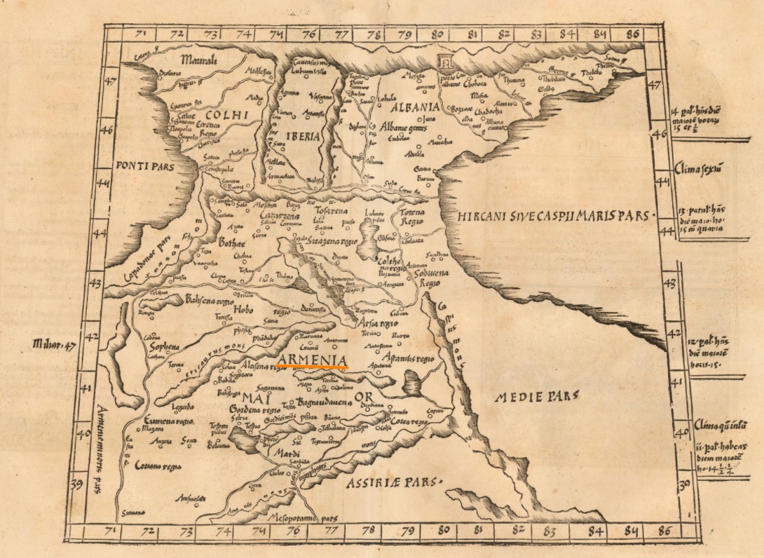
Tercia Asiae Tabula (Armenia, etc.), Map by Martin Waldeseemüller, Lorraine, 1513. “A striking specimen of the Waldseemuller map of the region between the two seas, the Black and Caspian, with centered in Armenia”.
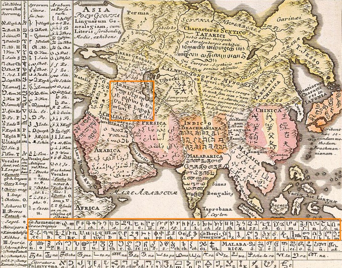
German linguist Gottfried Hensel’s Linguistic Map, 1741, Nuremberg. In some languages the first lines of the Lord’s prayer – “Our father who is in heaven”. In Armenian – “Հայ՛ր մեր, Որ յերկինս ես, Սուրբ եղիցի անուն Քո” and Armenian Alphabet.
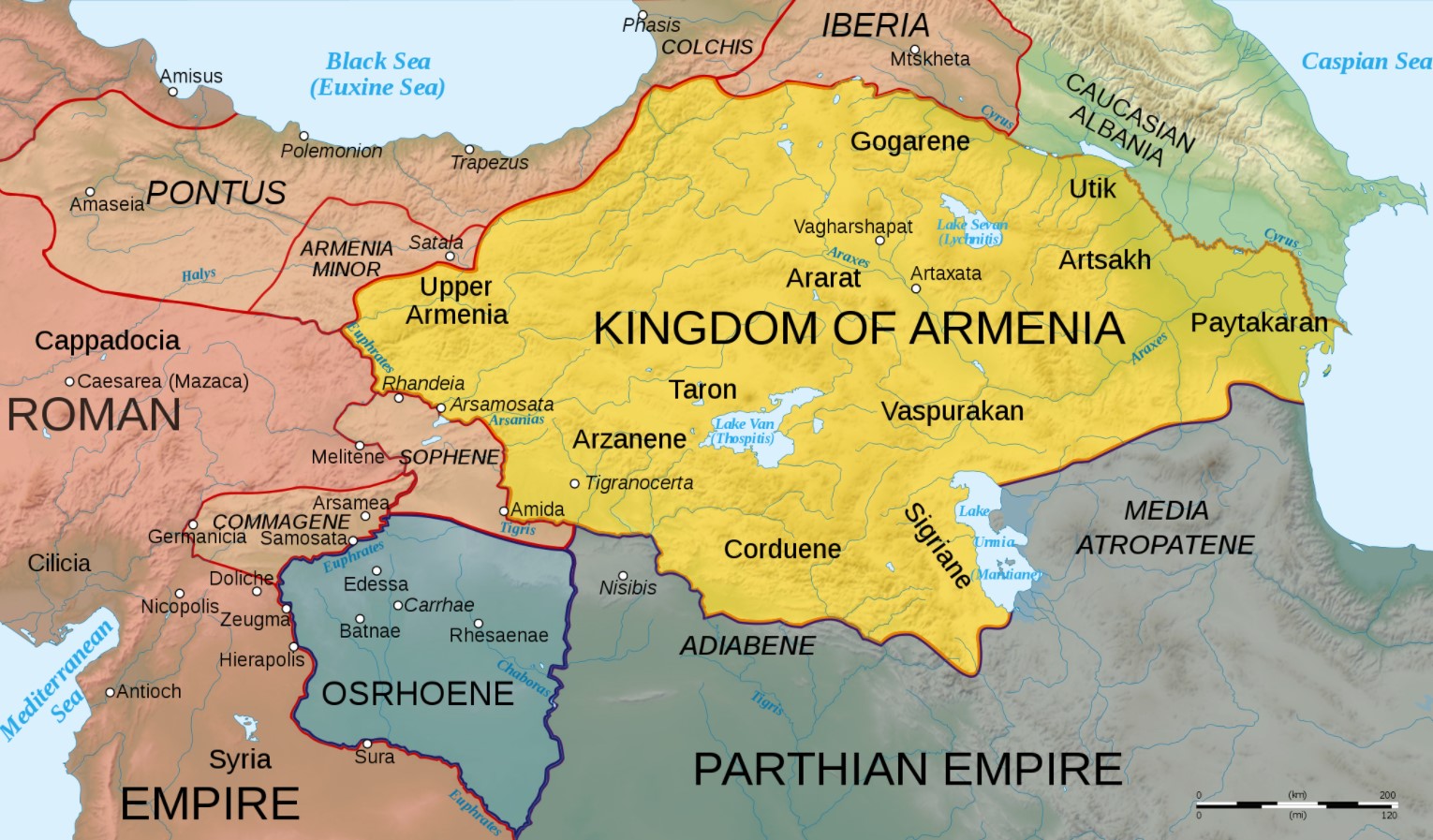
Map of Armenia and the Roman client states in eastern Asia Minor, ca. 50 CE, before the Roman-Parthian War and the annexation of the client kingdoms into the Empire.
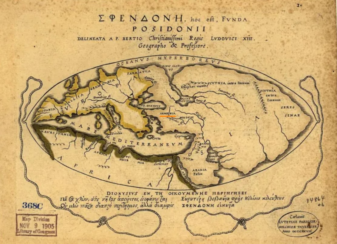
Armenia on the Map of the world according to Posidonius 1st c. BCE, Library of Congress, USA
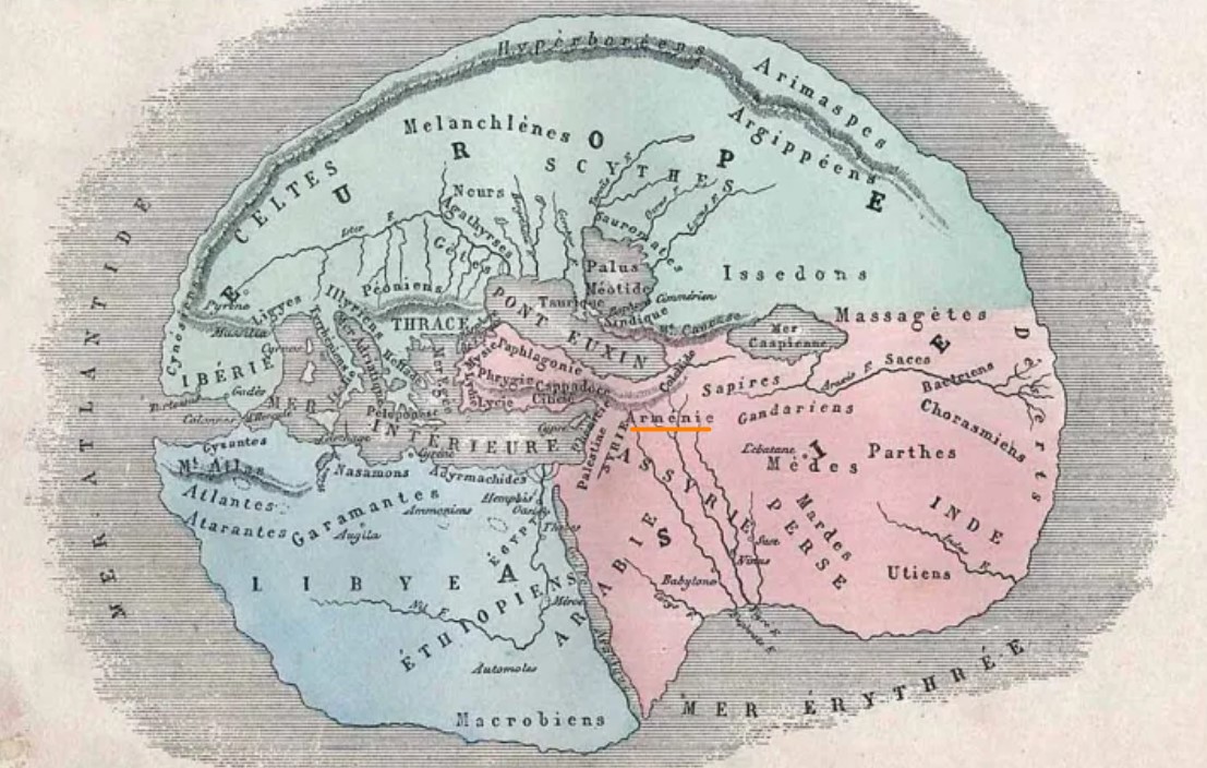
Armenia on antique world map according to Herodotus, 484–425 BC, by L. Fig, Hachette,1884.
Armenia on the world map according to Eratosthenes 276 – 194 BC., reproduced by A. Villemin in Earth and seas, or physical description of the world L. Figuier, Paris, Librairie Hachette, 1884.

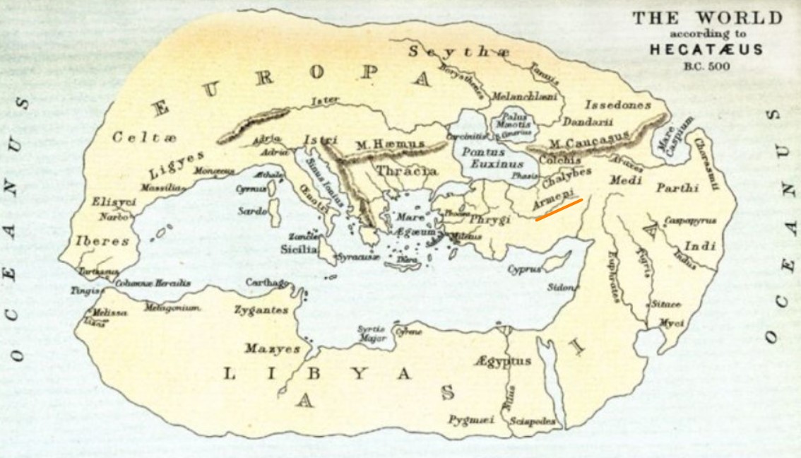
The world according to Hecataeus of Miletus B.C. 500. Hecataeus of Miletus (550 BC – 476 BC) – an early Greek geographer and historian, known as the “Father of Geography”.
Mappa di Eratostene, Eratosthenes’s map, 3-2 century B.C.
Eratosthenes – an Ancient Greek geographer, scientist, mathematician, poet, astronomer, and music theoris.

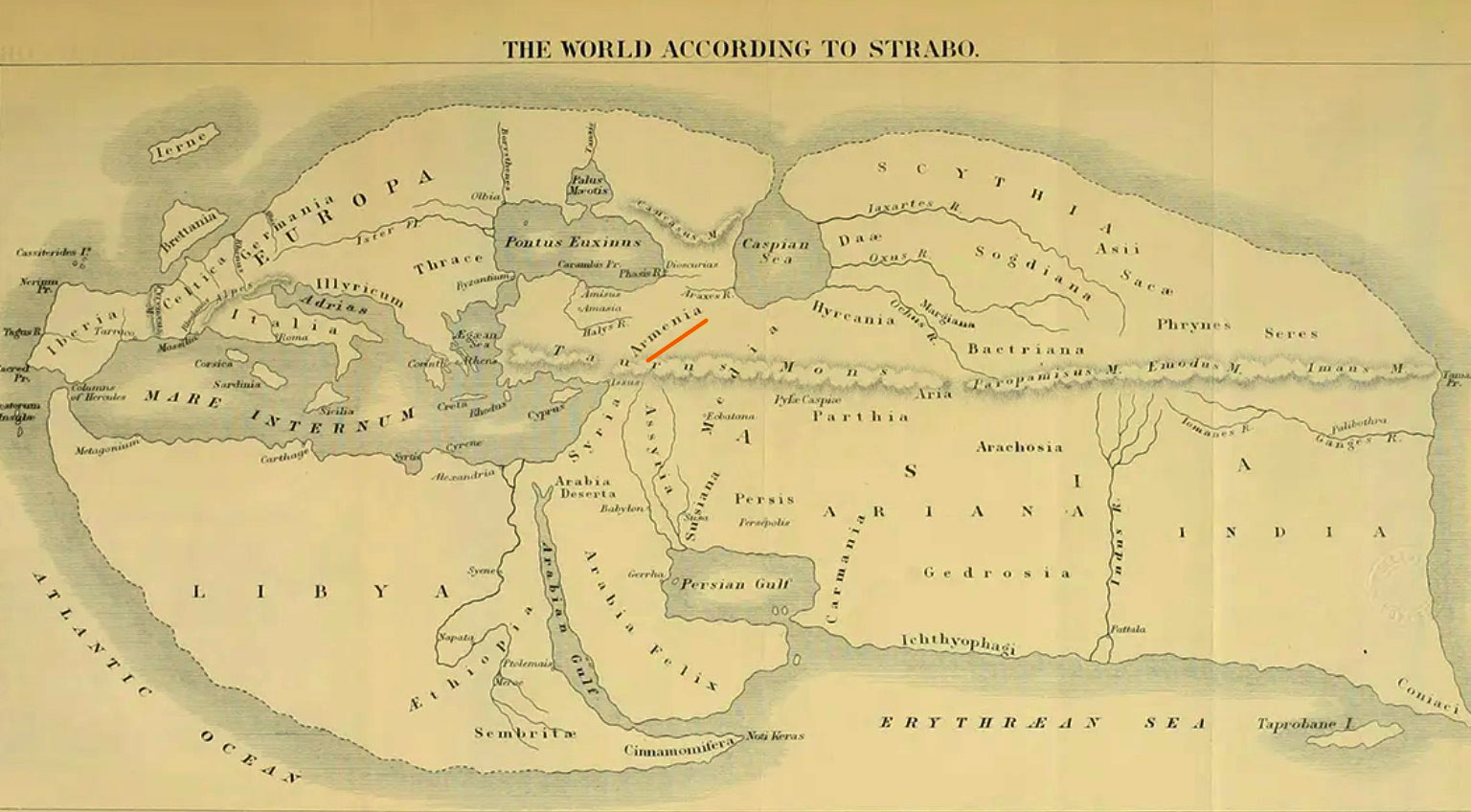
The World according Strabo,1st centuryB.C.
Strabo (ca. 64 B.C.-ca. A.D. 23) – a Greek geographer, philosopher, and historian.
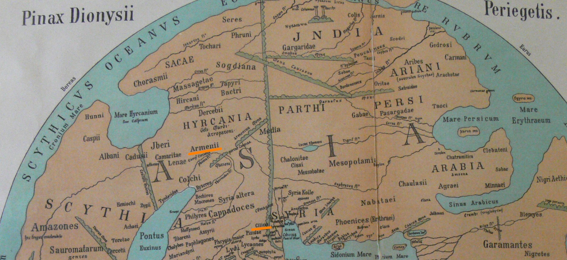
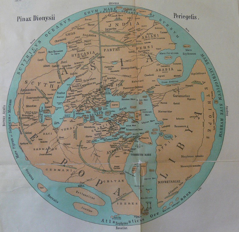
Dionysius Periegetes’ World Map, 24 A.D.
Dionysius Periegetes, Dionysius of Alexandria or Dionysius the African – 2nd century A.D. Greek travel writer.
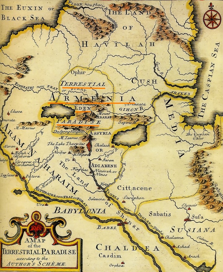
Terrestrial Paradise in Armenia according to Emanuel Bowen, 1694 -1767, British Royal Mapmaker.
The terrestrial Paradise Eden is located on the territory of Armenia, between the lakes Van and Kaputan. Mount Ararat is in the center of the map.
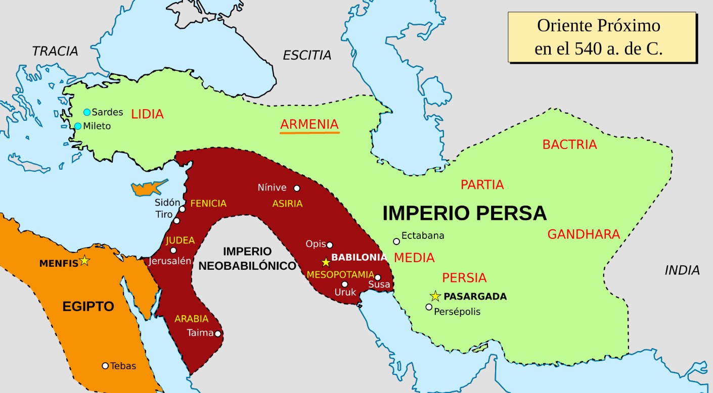
Map of the ancient Near East in 540 BC